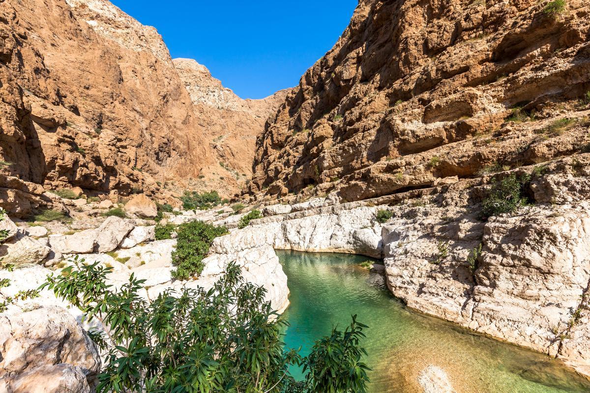
What Is a Wadi in Geography?

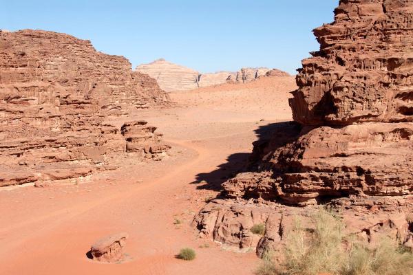
A wadi is a dry channel in that only transports water intermittently, usually after intense rainfall in arid and semi-arid regions. Essentially, it is a dry river bed because it was created by water which once passed through the channel. These channels are characteristic of deserts and other similar areas in North Africa, the Middle East and some parts of Asia. Their formation dynamics involve the action of sporadic rainfall that erodes the soil and transports sediments, contributing to the modelling of the landscape.
In this article from thedailyECO, we ask what is a wadi in geography? In addition to providing a definition, we look at how wadis are formed, what examples we can find and how they are different from a canyon.
What is a wadi in geography?
Also known as oued in Maghreb Arabic, a wadi (alternatively uadi) is an Arabic term used to describe a dry riverbed that may carry some water during periods of heavy rainfall. They are common in arid and semi-arid regions, especially in North Africa, the Middle East and parts of Asia.
For most of the year, a wadi looks like a dry valley or a river bed without water. When it rains suddenly and heavily, it can quickly fill up and become a strong and even dangerous stream due to flash floods. However, this does not happen with all wadis, with many remaining dry all year.
Wadis have been fundamental for many civilizations throughout history, since in some cases they allow the accumulation of underground water, facilitating agriculture and human settlement in desert areas. Wadis are also studied in geology and in urban planning to prevent flooding in areas with extreme climates.
Learn more about how underground water is stored with our article sharing the different types of aquifers.

How is a wadi is formed?
Wadis are formed over time due to water erosion in arid and semi-arid areas. Although they are usually dry for most of the year, their structure is the result of the intermittent action of torrential rains. Let's see what are the processes by which a wadi is formed:
- Intermittent river erosion: in desert regions, rainfall is rare. When it does occur, it is usually intense and sudden. As the soil in these areas is arid and compact, it does not absorb water well, causing large amounts of water to move quickly across the surface. In the process, this drags sediment and excavates the ground. Learn about the different types of erosion in geography with our related guide.
- Creation of temporary channels: over time, erosion creates depressions and grooves in the landscape, turning into dry channels when water evaporates or seeps into the subsoil. These channels can be small or extend for several miles.
- Sediment deposits: as the water flows, it carries rocks, sand and clay, which are then deposited in different parts of the wadi. As a result, its bed changes over time, forming sediment banks and altering its path.
- Formation of underground aquifers: in some cases, rainwater infiltrates the soil and is trapped in underground layers, creating small aquifers.
Learn more about how water distribution affects geographical features with our article asking what is an endorheic basin?

Examples of wadis in the world
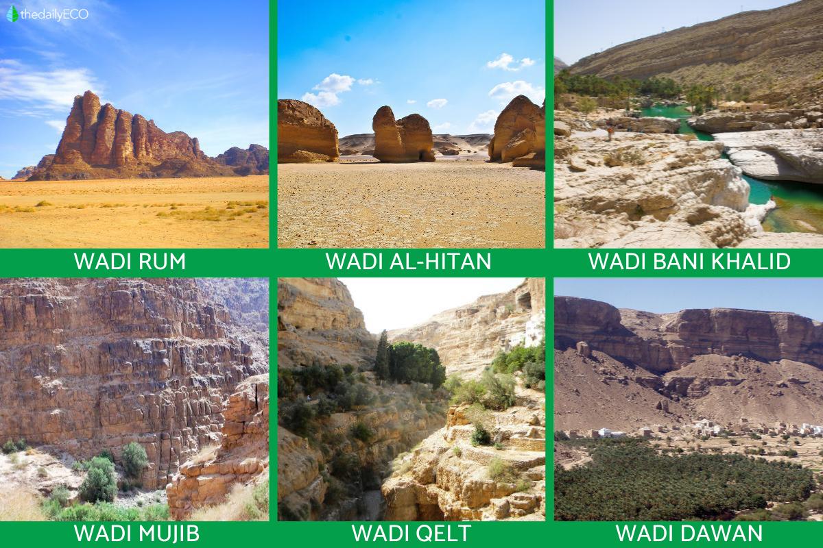
There are many wadis in different parts of the world, especially in arid and semi-arid regions. Some of the best known are:
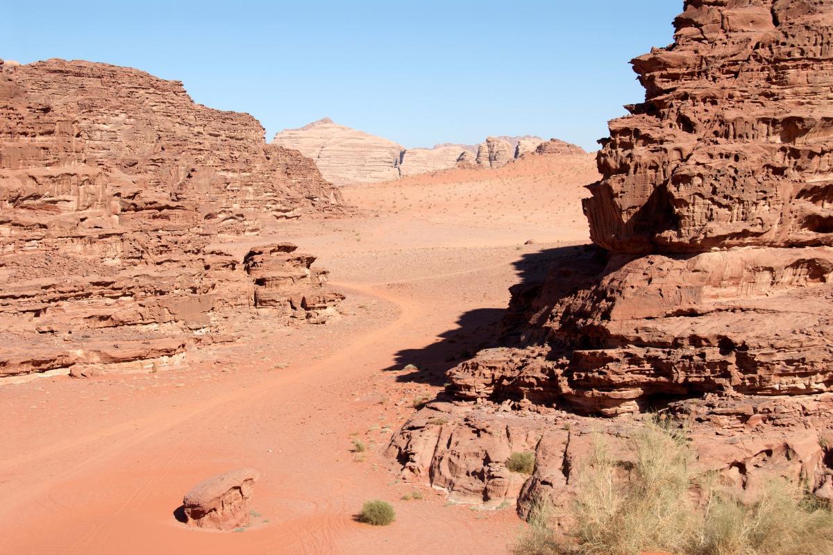
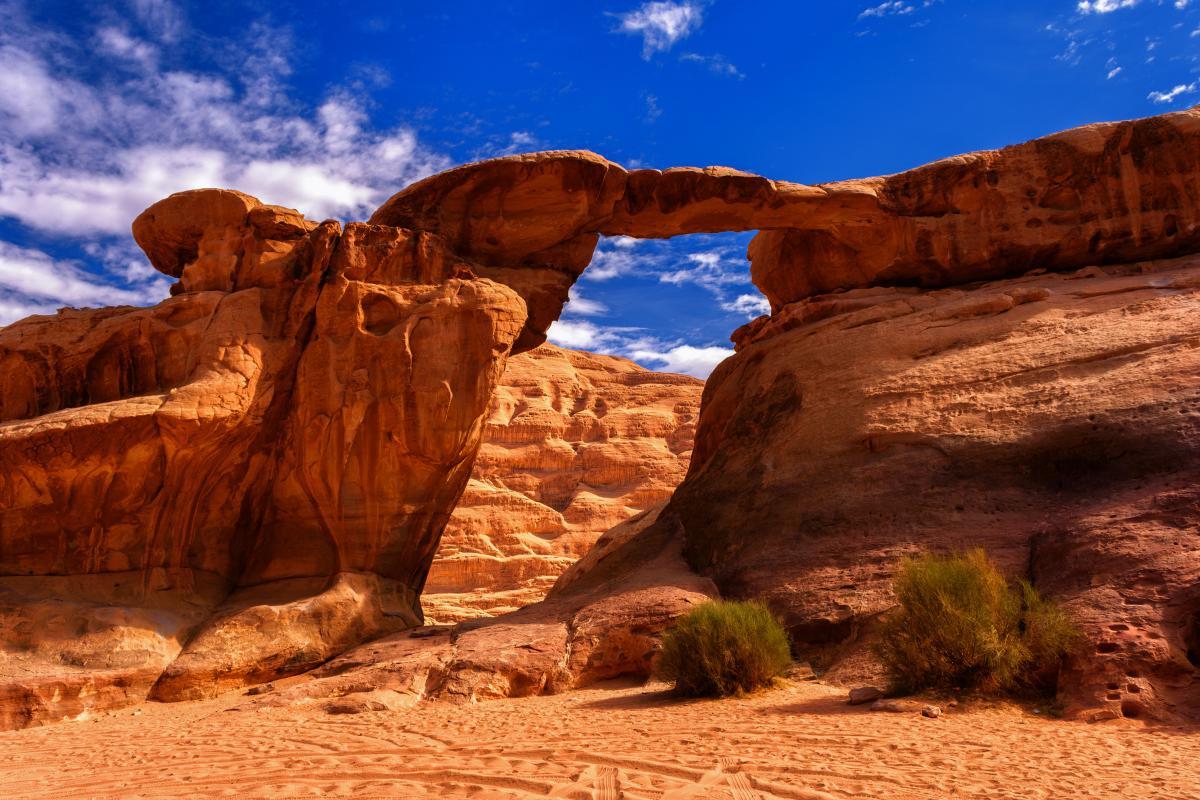
- Wadi Rum (Jordan): located in southern Jordan, this is one of the most famous wadis in the world. Known for its imposing rock formations and desert landscapes, it has been inhabited by Bedouin people for centuries and has served as a setting for films such as Lawrence of Arabia and The Martian. It is also known as the Valley of the Moon.
- Wadi Al-Hitan (Egypt): also called the Valley of the Whales, this wadi in Egypt is a paleontological site of great importance. As its alternate name suggests, it houses fossils of ancient whales with hind legs, demonstrating the evolution of these marine mammals. It was declared a World Heritage Site by UNESCO.
- Wadi Bani Khalid (Oman): unlike most dry wadis, this one in Oman has permanent water in parts, forming natural pools surrounded by palm trees. It is a popular tourist destination due to its beauty and the possibility of swimming in its crystal-clear waters. Learn more about water sources found in arid areas with our article explaining what is an oasis in a desert?
- Wadi Mujib (Jordan): known as the “Grand Canyon of Jordan”, this wadi is a nature reserve that flows into the Dead Sea. Its ecosystem is home to diverse species of flora and fauna. It is also a popular destination for hiking and canyoning.
- Wadi Qelt (West Bank, Palestine): a historic wadi connecting Jerusalem to Jericho. Over the centuries, it has been used as a trade route and a refuge for monks. On its cliffs lies the Monastery of St. George, a religious site of great importance.
- Wadi Dawan (Yemen): an impressive valley with villages built into the cliffs, famous for their adobe houses and their connection to the ancient Hadramaut culture. Despite being in an arid area, it is a fertile place thanks to the underground waters.

Difference between a wadi and canyon
The main difference between a wadi and a canyon lies in their formation, the flow of water and the type of landscape in which they are located:
- Wadi: is a dry channel that only transports water intermittently, usually after intense rainfall in arid and semi-arid regions. Its formation is the result of erosion caused by water on poorly permeable soils, where rainfall is scarce but intense. Wadis remain dry most of the time, except in rainy seasons when they can become dangerous torrents. They are common in North Africa, the Middle East and some areas of Asia.
- Canyon: in contrast, a canyon is a deep valley with steep walls, formed mainly by the continuous erosion of a river over thousands or millions of years. Unlike wadis, canyons usually have permanent water courses running through them. In some cases, the rivers may have dried up over time. They usually form in regions with sedimentary or very hard rocks, such as plateaus and mountains. They are found in various parts of the world, such as the Grand Canyon in the United States or the Colca Canyon in Peru.
Now that you know better about what a wadi is in geography and how it is formed, you may want to learn about the different types of deserts in which you may find one.
If you want to read similar articles to What Is a Wadi in Geography?, we recommend you visit our Ecosystems category.
- What are wadis? We tell you where you can find them. (2024). Marco Polo Club Community.
https://www.comunidadclubmarcopolo.com/que-son-los-wadis - Wadi Rum: what to see, what to do and other practical information. Jordan Exclusive. https://jordanexclusiva.com/destinations/southern-desert-highway/wadi-rum/
- Bordino, J. (2025). Wadi or uadi: what it is, how it is formed and differences with a canyon. https://www.geoenciclopedia.com/wadi-o-uadi-que-es-como-se-forma-y-diferencias-con-un-canon-1066.html


