What Is a Meteotsunami?


Have you ever been enjoying a calm day at the beach when suddenly the water rapidly recedes, only to come crashing back in a powerful wave? This unexpected surge might not be a traditional tsunami, but a meteotsunami, a giant wave caused by powerful weather events. Unlike its earthquake-triggered counterpart, meteotsunamis can sneak up quickly, posing a serious threat to unsuspecting beachgoers and coastal communities.
This article will equip you with the knowledge to identify these weather-made waves. We'll explore the science behind meteotsunamis, the dangers they present, and how they differ from traditional tsunamis. By understanding these unique events, you'll be better prepared to stay safe and enjoy your time by the coast.
What is a meteotsunami?
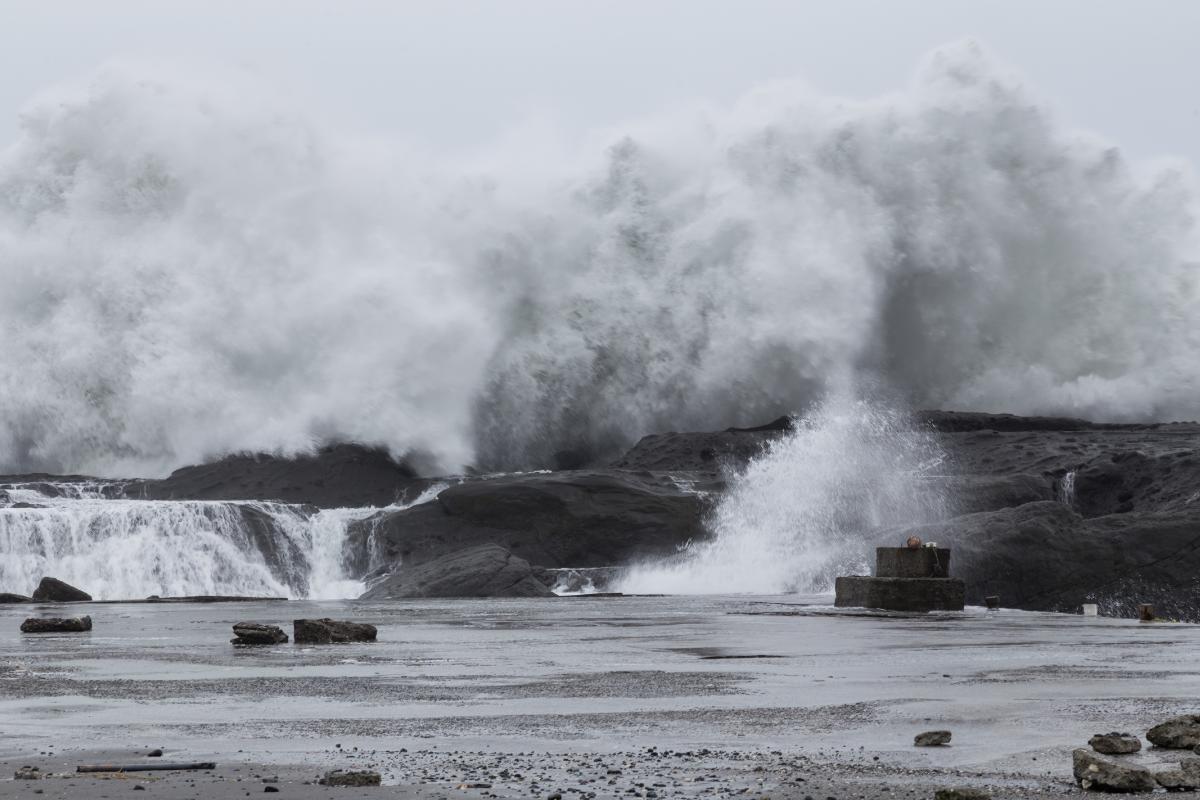
A meteotsunami, also called a weather wave or meteorological tsunami, is a sudden and large wave caused by rapid shifts in atmospheric pressure. Unlike seismic tsunamis from earthquakes, meteotsunamis happen because of changes in the atmosphere. These shifts lead to fast and unpredictable changes in water levels over a short period, potentially causing flash floods and coastal damage.
These events are common in specific regions where the right geographical and atmospheric conditions come together. Meteotsunamis tend to occur in shallow coastal areas with a gentle slope toward the sea, which allows the wave to get bigger as it nears land. Bays, gulfs, and estuaries are especially at risk.
The shape of the seafloor also affects how a meteotsunami wave behaves. Underwater features like ridges or canyons can act as channels, focusing the wave's energy and making it taller when it reaches shore.
The strength and speed of the pressure change during a weather event are critical. Powerful storms with a rapid drop in pressure are more likely to trigger a significant meteotsunami. Wind direction also plays a role in how the wave interacts with the coastline, influencing its impact when it arrives at shore.

How is a meteotsunami made?
As mentioned earlier, meteotsunamis are triggered by atmospheric disturbances such as thunderstorms, squall lines, weather fronts, or atmospheric gravity waves. These events cause rapid changes in atmospheric pressure and generate strong winds. Let's take a closer look at how meteotsunamis are formed:
- The rapid changes in atmospheric pressure and strong winds create waves on the sea surface. These waves are similar to those produced by a moving ship but on a much larger scale.
- For the waves to amplify, the speed of the atmospheric disturbance must match the speed of the sea waves, creating a resonance effect. This resonance amplifies the waves as they travel.
- The generated waves propagate towards the coast. The topography of the seabed and the shape of the coastline play a crucial role in this stage. In areas with wide continental shelves and narrow bays, the waves can concentrate and amplify as they approach land.
- When the waves reach the coast, they interact with the coastline's shape and the seabed's characteristics. In bays or ports with certain geometric features, waves can increase significantly in height due to resonance and topographic amplification effects.
- The result is a series of rapid and pronounced oscillations in sea level. These oscillations can cause the water to rise and fall several meters in a matter of minutes. This behavior is similar to that of a tsunami but is driven by atmospheric disturbances rather than seismic activity.
Curious about the long-term changes to coastlines? Explore the ongoing process of erosion in our other article on how coastlines are constantly reshaped.
Consequences of meteotsunamis
Meteotsunamis, although less well known than conventional earthquake-generated tsunamis, can pose serious dangers to coastal areas:
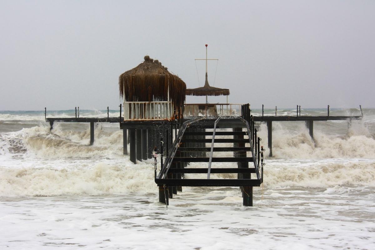
- Meteotsunamis can cause rapid and significant rises and falls in sea level, leading to flash flooding in coastal areas. This type of flooding can happen within minutes, leaving little time for evacuation and preparation. Infrastructure near the water, such as ports, marinas, and coastal establishments, is particularly vulnerable.
- The force and speed of the water movement during a meteotsunami can cause serious damage to coastal infrastructure. Docks, boats, roads, and buildings near the sea can be destroyed or severely damaged. Moored boats can break free from their moorings and be swept away, colliding with other boats or the coastline.
- Meteotsunamis pose a significant danger to human life, especially for those near the water or in small boats. The sudden and powerful nature of these waves can catch people off guard, leading to potentially fatal situations.
- Meteotsunamis can have a considerable economic impact on coastal communities. Damage to infrastructure and vessels, along with disruptions to economic activities such as fishing and tourism, can result in significant financial losses.
To venture further into the realm of tsunamis and witness the most destructive wave ever documented, head over to our related article on history's most colossal tsunami.

Where do meteotsunamis commonly occur?
Meteotsunamis can occur in many places around the world, but some areas are more prone to them than others. Here are some common locations:
- Due to their large size and relatively shallow depth, the Great Lakes in the United States are particularly susceptible to meteotsunamis. These events occur most often in the summer months when squall lines move across the lakes. On average, there are around 126 meteotsunami events on the Great Lakes every year.
- The Atlantic Coast of the United States experiences around 25 meteotsunamis per year, with particularly frequent events in the Carolinas, near Atlantic City, and along the Long Island Sound.
- Research suggests the northeastern Gulf of Mexico experiences frequent meteotsunamis, with an average of 1-3 events exceeding half a meter in wave height occurring annually. The northwestern Florida coast sees meteotsunamis primarily due to winter storms, while the western and southwestern regions experience them year-round.
- The Mediterranean and Adriatic seas being semi-enclosed basins are susceptible to meteotsunamis due to their limited tidal range, making rapid sea-level changes more impactful. Specific atmospheric conditions, like strong southwesterly jet streams, can increase the risk of meteotsunamis in these regions.
Curious about the colossal waves triggered by earthquakes and other forces? Explore the how and why of tsunamis in our other article on the forces that unleash mega-waves.
What is the difference between tsunamis and meteotsunamis?
Tsunamis and meteotsunamis are both types of large sea waves, but they differ significantly in their causes and characteristics:
Causes:
- Tsunamis are primarily caused by underwater earthquakes, especially those occurring at tectonic plate boundaries. These include underwater or coastal volcanic eruptions, underwater or coastal landslides and, though rare, large meteorite impacts in the ocean.
- Meteotsunamis, on the other hand, are generated by rapid changes in atmospheric pressure, strong winds, or severe storms. These atmospheric conditions can cause the displacement of large amounts of water.
Speed:
- Tsunamis can travel at speeds of up to 500-800 km/h (310-500 mph) in the open ocean.
- Meteotsunamis typically travel at slower speeds compared to tsunamis, often around 20-50 km/h (12-31 mph).
Wavelengths:
- Tsunami waves have very long wavelengths, often hundreds of kilometers.
- Meteotsunami waves have shorter wavelengths compared to tsunamis, usually less than 100 km.
Frequency:
- Tsunamis are relatively rare events, particularly large, destructive ones.
- Meteotsunamis are more frequent than large tectonic tsunamis, but are often less widely recognized and understood.
Detection and warning
- Tsunami detection relies on a network of seismographs, tide gauges, and deep-ocean tsunami buoys (DART buoys) to monitor seismic activity and sea level changes. Established tsunami warning systems can provide alerts minutes to hours before a tsunami reaches the coast, depending on the distance from the source.
- Meteotsunamis are more challenging to detect because they are driven by atmospheric conditions. Meteorological data, such as rapid changes in air pressure and wind patterns, are used to identify potential meteotsunami conditions. Meteotsunami warning systems are less developed compared to tsunami warning systems. Forecasting and providing timely warnings for meteotsunamis is more difficult due to their dependence on rapidly changing weather conditions.
Severity:
- Tsunamis are typically more severe and have greater destructive potential due to their higher wave heights, faster speeds, and ability to inundate larger areas.
- Meteotsunamis often affect localized coastal areas rather than entire coastlines or regions. The impact can vary depending on the intensity and duration of the atmospheric disturbance. Meteotsunamis are generally less powerful compared to tsunamis.
This article explored meteotsunamis, but the ocean holds many more wonders. Discover the fascinating composition of our planet's water in our other article on the building blocks of the ocean.
If you want to read similar articles to What Is a Meteotsunami?, we recommend you visit our Meteorological phenomena category.


