Also known as salt deserts or salt flats, salt pans are vast expanses of land which are covered by a layer of minerals, mostly in the form of sodium chloride salt. They are considered extreme environments since this concentrated amount of salt makes it very difficult for organisms to survive. Salt flats form due to evaporation from land which once contained saltwater, leaving the residual minerals behind. They are of great geological, ecological and economic importance. You can se why as thedailyECO asks what are salt pans? We explain their characteristics and formation, as well as provide examples found around the world.
What are salt pans?
Salt pans or salt flats are vast expanses of land covered by a thick layer of salt, usually formed on ancient lakebeds or seabeds that have evaporated over time. This is due to the rate of evaporation over time being greater than that of precipitation. This is what happens in the climate of a desert ecosystem, the reason salt pans are also known as salt deserts.
The appearance of salt pans can be quite surreal. Since the rate of evaporation is due to intense sunlight, the salt flats reflect the sun off their white surfaces. This can create an intensity of light which is difficult to bear, as well as causing mirages and other natural optical effects.
Salt pans can be found in various parts of the world, although they are most common in arid regions. Some of the most famous include the Salar de Uyuni in Bolivia, which is the largest salt flat on the planet. We can also find the Salar de Atacama in Chile and the Great Salt Lake in the United States. Each has unique characteristics, from hexagonal patterns on the surface to layers of water that create perfect reflections of the sky.
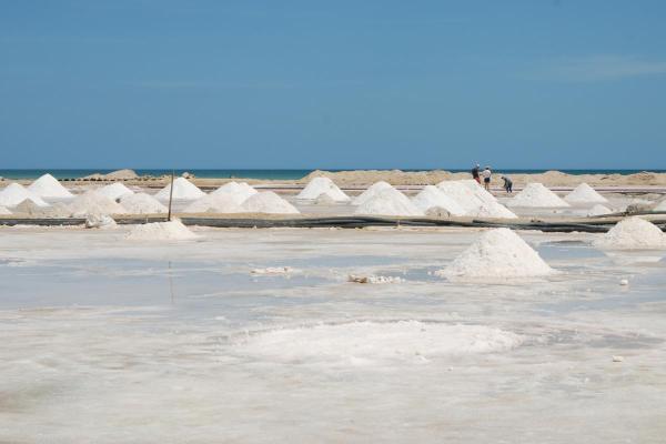
In addition to their natural beauty, salt pans are of great economic importance. Many of them contain large reserves of minerals such as lithium, a key element in battery manufacturing. Potassium and boron are some other elements which can be found in large amounts in salt pans. In some cases, they are also sources of table salt, extracted using industrial or traditional methods.
These extreme ecosystems are home to life forms adapted to harsh conditions. Although they may appear desolate, some microorganisms thrive in the saline environment. At certain times of the year, they even become temporary refuges for flamingos and other migratory birds.
Salt pans not only attract the interest of scientists and geologists, but also travelers and photographers seeking to capture their uniqueness. Many of these places have served as locations for films, commercials and scientific explorations, becoming popular tourist destinations.
Learn more about the diversity of arid ecosystems with our article sharing the different types of deserts.

How are salt pans formed?
Salt pans don't appear overnight. Their formation is a geological process that can take thousands or even millions of years. We better understand these processes by taking a step-by-step look at salt pan formation:
- Presence of a body of water: natural salt pans begin with a lake, inland sea or saline water basin. These bodies of water are usually located in arid or semi-arid areas where evaporation is intense and water replenishment is limited.
- Salt and mineral accumulation: the rivers and tributaries that feed the lake carry small amounts of dissolved salts and other minerals. These substances become concentrated in the water over time as they have no escape route to the ocean.
- Progressive evaporation: due to the high temperatures and low rainfall in these regions, water begins to evaporate faster than it is replenished. This causes an increase in the concentration of salt and other dissolved minerals.
- Formation of salt deposits: when the water reaches a critical saturation point, salts begin to precipitate and settle to the bottom of the lake. This process occurs continuously, accumulating layers of salt over thousands of years.
- Complete disappearance of water: if evaporation persists and there is no water source to maintain the balance, the lake or sea eventually dries up completely. A salt crust remains that can extend for kilometers, giving rise to a salt desert.
- Landscape shaping: the surface of the salt pan can change over time due to climatic factors. Occasional rainfall can dissolve and rearrange the salt crystals, creating geometric patterns. Wind can sculpt structures or even partially cover the salt flat with sand.
This is how natural salt pans are created, something which is different from industrial salt flats which are used to create salt reserves. You can better understand the difference with our article on what are salt flats and how are they formed?
Names of the largest natural salt pans
There are several salt pans across the world that stand out for both their size and their unique characteristics. Let's take a look at the details and characteristics of some of the largest and most impressive salt pans:
- Salar de Uyuni (Bolivia): this is the world's largest salt pan, covering approximately 10,500 km². It was formed by the evaporation of ancient prehistoric lakes and is famous for its smooth, white surface, which becomes like a giant mirror reflecting the sky during the rainy season. It also houses one of the largest lithium reserves on the planet.
- Salar de Coipasa (Bolivia): located near the Salar de Uyuni, this salt flat covers approximately 2,200 km². Although less well-known, its landscape is equally impressive and features a small lake in its center, making it unique among salt deserts.
- Salar de Atacama (Chile): at approximately 3,000 km², this is Chile's largest salt flat and is located in one of the driest regions on the planet. Its uneven surface is surrounded by volcanoes. It is also a key ecosystem for wildlife, home to several lagoons with flamingos and other birds.
- Salar del Hombre Muerto (Argentina): this approximately 600–700 km² salt flat is one of Argentina's main sources of lithium. Its landscape is a combination of salt, sand, and turquoise lagoons due to the presence of minerals.
- Salar de Arizaro (Argentina): this is the second largest salt flat in Argentina and one of the largest in South America, covering approximately 1,600 km². It is distinguished by its mineral wealth and mountainous surroundings, which give it a landscape distinct from other salt deserts.
- Great Salt Lake (United States): Located in the state of Utah, this hypersaline lake has been shrinking over time, resulting in some areas of its surface becoming salt pans. Although its size varies depending on the season, it has once covered up to 4,400 km². It is famous for its pink hues and for being the habitat of numerous migratory birds.
- Makgadikgadi Salt Pan (Botswana): this is one of the largest salt pans in Africa, covering 16,000 km² across all its sections. Located in the Kalahari Desert, it is an important wildlife destination, especially during the rainy season when flamingos and other animals visit.
Now we have learned about salt pan formation and examples, you may want to learn more about the origin of some with our article asking are there salt water lakes?

If you want to read similar articles to What Are Salt Pans?, we recommend you visit our Environment (other) category.
- Ingeoexpert. (2020). Salar de Uyuni: Bolivia's salt flats.
https://ingeoexpert.com/2020/08/21/salar-de-uyuni-el-desierto-de-sal-de-bolivia/?srsltid=AfmBOorY0ewwsG5WtjTbO7CtBuLVGFFWzXKSaUPNCCaxkUAosCaxL1UB - Sal Roca. (2023). Salt deserts, a natural wonder.
Available at: https://blog.salroca.es/desiertos-de-sal/