What Are Cirrus Clouds Made Of?


Cirrus clouds are a type of wispy cloud that forms in the upper layers of the atmosphere, generally above 6,000 meters. They are composed mainly of ice crystals. There are numerous types of cirrus clouds with specific classification according to their characteristics such as formation and meteorological meaning. In this thedailyECO article, we ask what are cirrus clouds made of? We also look at their formation and the classification of the different types of cirrus clouds.
What are cirrus clouds and what are they made from?
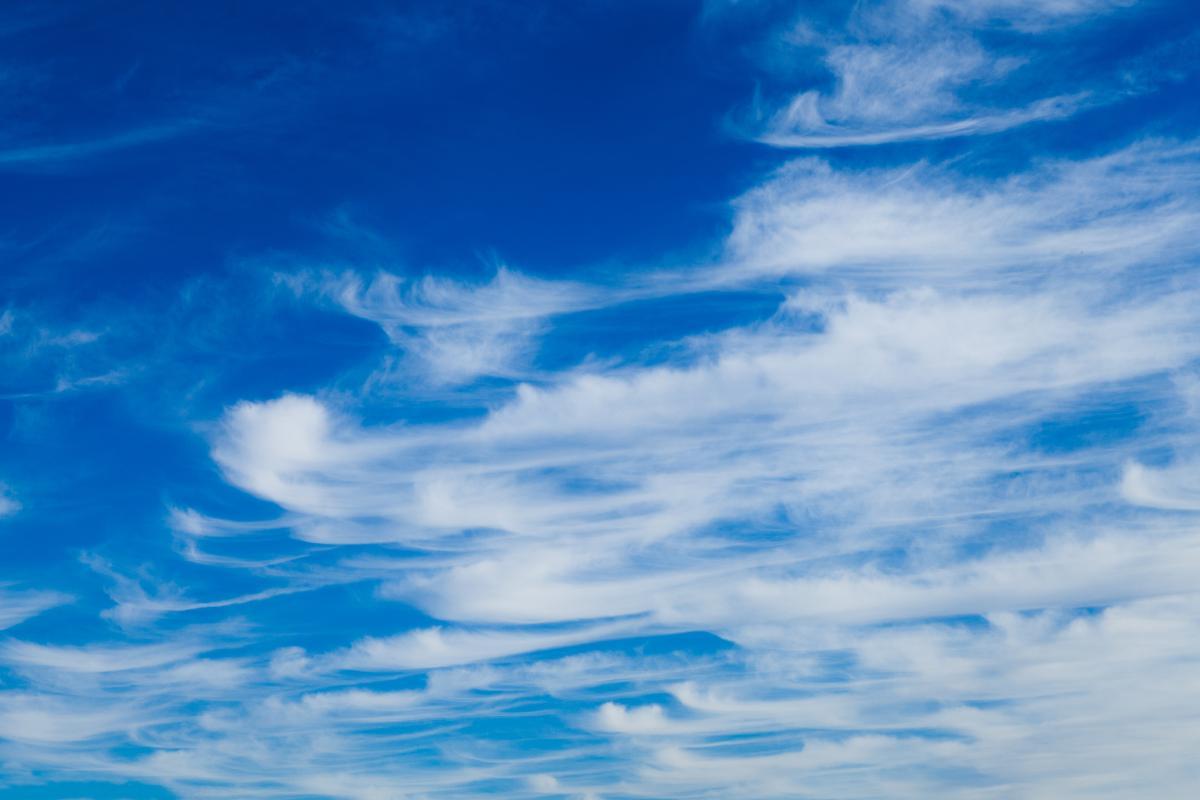
Cirrus clouds are a type of cloud that forms in the upper layers of the atmosphere, generally at altitudes above 6,000 meters. These wispy clouds are easily recognizable by their delicate and fibrous appearance, similar to strands of hair or feathers. Their color is usually bright white. This is because cirrus clouds are made almost exclusively of ice crystals due to the low temperatures at the heights where they form.
What are cirrostratus?
Cirrostratus are a subtype of cirrus clouds that are characterized by their more uniform and widespread appearance, often covering large areas of the sky with a thin, translucent layer. These clouds form at altitudes similar to those of cirrus clouds, but can be a little lower. For this reason, they may be made of minimal amounts of supercooled water droplets in addition to ice crystals.
One of the most distinctive features of cirrostratus clouds is their ability to create halos around the sun or moon. Cirrostratus usually appear before the arrival of more complex weather systems, such as warm fronts or storms. Their presence indicates there is a considerable amount of moisture in the upper atmosphere, which may be a precursor to precipitation later on.
What are cirrocumulus clouds?
Cirrocumulus clouds are another subtype of wispy cirrus clouds that are distinguished by their appearance as small, white, clustered formations. They often a wavy or mottled appearance that can be reminiscent of fish scales. These clouds also form at high altitudes, typically above 6,000 meters, where temperatures are low enough for ice crystals to form.
Unlike cirrostratus, cirrocumulus clouds do not cover large areas of the sky uniformly. Instead, they appear in patches or rows, giving the sky a distinctive texture. This fragmented appearance is due to rising and falling air currents in the upper atmosphere, which create small pockets of warmer and colder air, leading to the formation of these clouds. They may also be made of small amounts of supercooled water droplets in addition to ice crystals.
A notable feature of cirrocumulus clouds is their ability to create a visual effect known as a mackerel sky, due to their regular, clustered pattern which are similar to the scales on a mackerel fish. This phenomenon is not only interesting from an aesthetic point of view, but can also be used by weather observers to better understand atmospheric conditions.
Learn more about another type of cloud which develops patterns in the sky with our article on what are altocumulus clouds?

How do cirrus clouds form?
We now know what cirrus clouds are made from ice crystals, but how do these crystals form a cloud? We find out by understading the process of cirrus cloud formation:
- For cirrus clouds to form, humid air must rise to high altitudes. This can occur through several mechanisms such as convection, convergence of air at low levels or upward movement associated with weather fronts. As air rises, it expands and cools due to lower atmospheric pressure at higher altitudes.
- At altitudes where cirrus clouds form, temperatures are extremely low, generally below -20°C (-4°F). Under these conditions, water vapor condenses directly into ice crystals rather than into liquid water droplets.
- Ice crystals are formed from water vapor that condenses on small particles of aerosols present in the atmosphere. These include dust, sea salt or particles of biological origin. These ice crystals grow as more water vapor settles on them, giving rise to the delicate, wispy structure of cirrus clouds.
- Once formed, cirrus clouds can be dispersed and shaped by winds in the upper troposphere. Air currents at these altitudes are generally strong and can stretch and elongate ice crystals, creating the typical thin and elongated shapes that characterize cirrus clouds.
To learn more generally about this process, we ask what are clouds and how do they form?
Classification of cirrus cloud types
The classification of cirrus clouds is based on their visual characteristics and the structures they form in the sky. There are several subtypes of cirrus, each with its own characteristics:
Cirrus
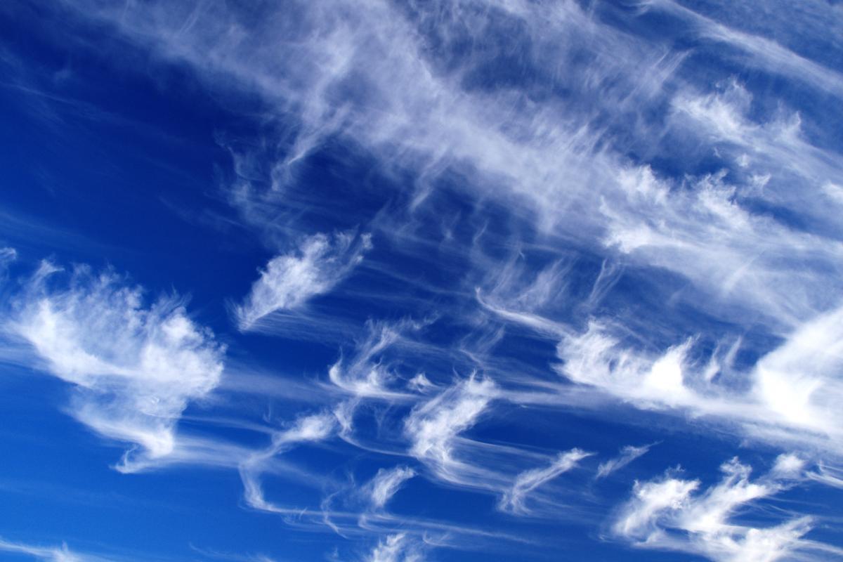
Cirrus are the basic type of cirrus, characterized by their thin, wispy and white appearance. These clouds often look like strands of hair or feathers, forming at high altitudes. Cirrus are divided into several subtypes:
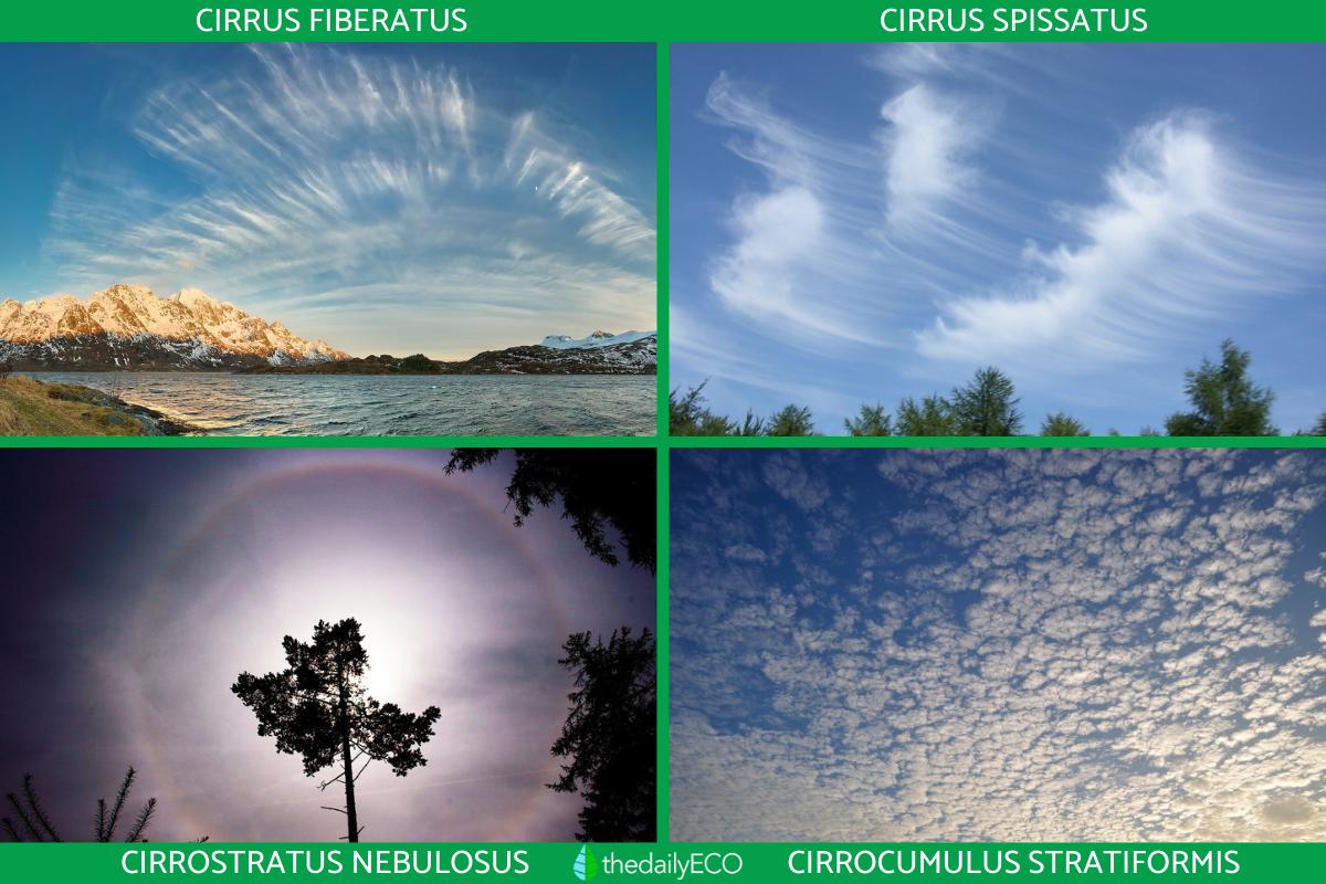
- Cirrus fiberatus: this subtype features long and thin filaments that are often aligned in parallel or dispersed irregularly.
- Cirrus uncinus: these cirri have the appearance of hooks or commas, with a narrow base that curves upward. They are often known as ponytails and can also be indicative of a change over time.
- Cirrus spissatus: this subtype is denser and thicker than other cirri, giving them a duller appearance. Cirrus spissatus are often associated with dissolving storm clouds.
Cirrostratus
Cirrostratus are clouds that form a uniform, thin layer that can cover the entire sky. These clouds are usually translucent and allow the sun or moon to be seen through them, creating halos in the process. Cirrostratus are also subdivided into:
- Cirrostratus nebulosus: this subtype appears as a continuous and homogeneous layer of wispy clouds, without distinguishing characteristics. Nebulous cirrostratus are responsible for the formation of halos around the sun or moon.
- Cirrostratus fiberatus: similar to Cirrus Fiberatus, but forming a more extensive and thinner layer.
Cirrocumulus
Cirrocumulus are clouds that appear as small clumps arranged in groups or rows. They have a mottled or wavy appearance which provide a mackerel sky effect as seen in the photo below. Cirrocumulus are classified into several subtypes:
- Cirrocumulus stratiformis: this subtype occurs in widespread layers covering parts of the sky, with small individual clouds grouped together evenly.
- Cirrocumulus lenticularis: these clouds have a lenticular or lens shape and are less common than other types of cirrocumulus cloud. Their formation is associated with mountains or hills, where ascending and descending air flows create wavy patterns.
- Cirrocumulus castellanus: these clouds have towers or structures rising from their base, giving them a more vertical appearance. Cirrocumulus castellanus can be an indication of atmospheric instability and potential for storms.

With what type of weather are cirrus clouds associated?
Cirrus clouds are often precursors of changes in the weather. Their appearance can signal the arrival of warm fronts, cold fronts or low pressure systems. This is because cirrus clouds form at higher altitudes in the troposphere where atmospheric conditions can change rapidly.
The arrival of cirrus clouds may be a sign of an approaching warm front. As warm, moist air rises over cold air, cirrus clouds form. This is followed by cirrostratus and eventually altostratus and nimbostratus which can bring rain.
The presence of cirrus uncinus can indicate the approach of a cold front or severe storms. These cirrus clouds form due to intense updrafts associated with developing storms. The presence of cirrus clouds can also indicate conditions of atmospheric stability in the upper layers of the atmosphere.
Now that you know what cirrus clouds are made of and how they form, you may want to know more about storm cloud formation with our article asking how do cumulonimbus clouds form?
If you want to read similar articles to What Are Cirrus Clouds Made Of?, we recommend you visit our Meteorological phenomena category.


