What Are Cirrocumulus Clouds?


Cirrocumulus are a type of cloud that forms at high altitudes, generally more than 6,000 meters above sea level. They are composed of small ice crystals. They are characterized by their appearance in groups of small white clouds that are organized in regular patterns, often being compared to fish scales. In this article from thedailyECO, we discover more by asking what are cirrocumulus clouds? In addition to providing a definition, we look at their formation, the different types that can appear and photos to better recognize these clouds for yourselves.
What are cirrocumulus clouds?
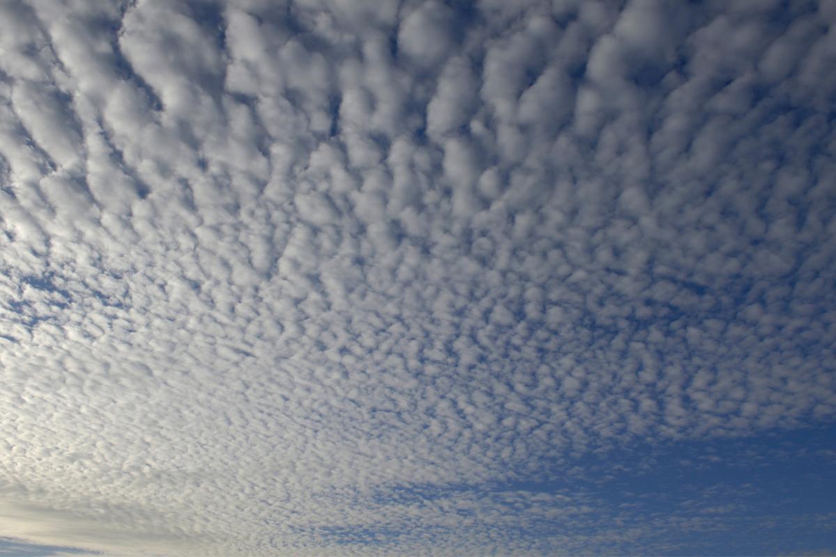
Cirrocumulus clouds are a type of cloud that forms at high altitudes, usually more than 6,000 metres (20,000 ft) above sea level. They are distinguished by their appearance of small white or grey patches that are grouped together. The patterns these groupings create can vary in appearance, with some looking like the scales of a fish and others appearing to have a more wooly texture.
When we refer to cirrocumulus, we can describe this as a genus of cloud with various species within it. It is one of the three main genera of clouds, with cirrus and cirrostratus being the other two. The individual species are differentiated by their structure and appearance, such as their groupings, opacity and size.
Clouds of the cirrocumulus genus are unlike most other clouds. This is because they are made of ice crystals rather than water droplets. The reason for this is their altitude. The greater height means lower temperatures and the formation of ice crystals. You can read our article on what are altocumulus clouds if you want to know more about how altitude affects cloud formation.
The appearance of cirrocumulus clouds usually indicates an approaching change in weather, usually preceding frontal systems or storms. Although they do not usually produce precipitation, their presence can be a sign that the weather is going to become more unstable in the next few hours or days.
To know more general information about these meteorological phenomena, you can take a look at our article which asks what are clouds and how do they form?
How do cirrocumulus clouds?
Cirrocumulus clouds form when warm and moist air masses rise to high altitudes. When they do so, they encounter cooler layers of air. At such a high altitude, temperatures are low enough that water vapor in the air condenses directly into tiny ice crystals, rather than water droplets. This cooling process is what allows these clouds to form.
Cirrocumulus clouds often appear when a jet stream or cold front approaches. These conditions tend to create the instability necessary for air to rise rapidly. The characteristic structure of cirrocumulus is the form of small clusters of cumulus, occurring due to variations in humidity and temperature within the layers of the atmosphere. These differences create small convection cells that organize ice crystals into regular patterns.
It is important to note that cirrocumulus clouds form in a dry environment. Despite their presence, this explains why they do not produce rain, snow or most other types of precipitation. Rarely, they may produce virga, a form of precipitation which does not reach the ground and remains in the atmosphere. This is commonly known as a dry storm.
Learn more with our article explaining what is virga in weather?

Types of cirrocumulus clouds
As we have explained, cirrocumulus clouds are a genus of clouds in which individual species exist. These species grouped according to their shape, structure and arrangement. This means these species or subtypes are classified primarily based on the visible features in the sky and conform to the following patterns:
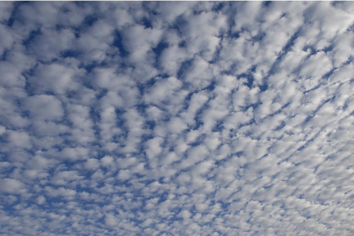
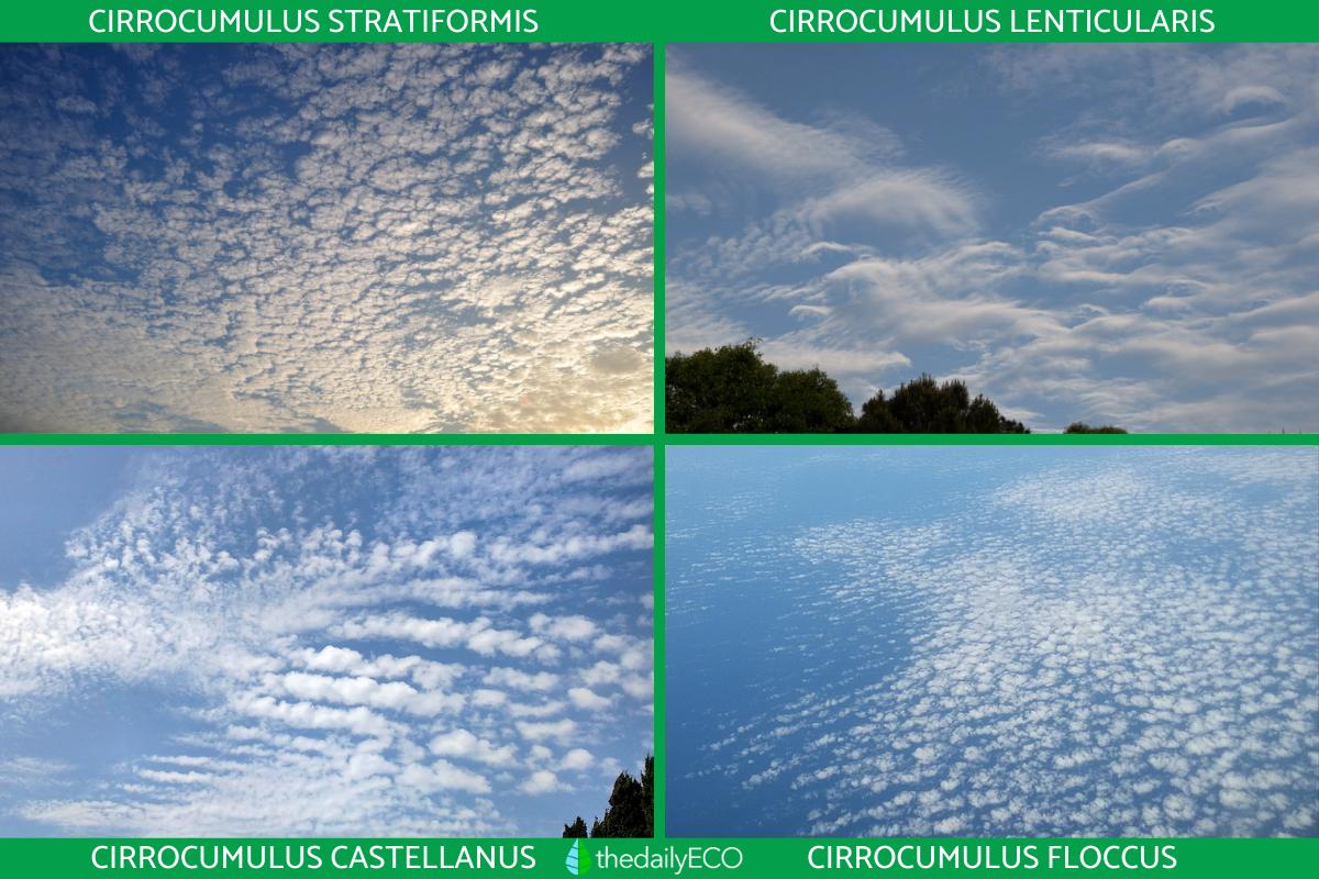
- Cirrocumulus stratiformis: this is the most common type of cirrocumulus cloud. It appears in large areas that cover a large part of the sky, forming a continuous layer of small grouped clouds. Its appearance is similar to the scales of a fish. They are usually organized in neat rows or regular patterns.
- Cirrocumulus lenticularis: these cirrocumulus clouds are shaped like a lens or disk, often appearing in mountainous regions or where air is flowing rapidly over other tall obstacles. The airflow forms waves. The clouds develop on the crests of those waves, creating these lenticular clouds which can look like flying saucer UFOs in appearance.
- Cirrocumulus castellanus: the structure of these clouds has protuberances or turrets that stick out, like small towers on the top of the cloud. This type is usually an indication that there is some atmospheric instability, which could foreshadow changes in the climate.
- Cirrocumulus floccus: these are small, fluffy clouds, which often have a diffuse base and may appear somewhat ragged. They may sometimes be accompanied by a shadow at their base, giving them a more voluminous appearance.
Although these cirrocumulus subtypes vary in appearance, they all share their location in the upper layers of the atmosphere and their formation from ice crystals. Despite being visually different, they serve a similar role in the atmosphere, often as precursors to major weather changes. You can see photos of the types of cirrocumulus clouds below.
Discover the differences in certain major weather events with our article comparing tornadoes vs. hurricanes.

Meteorological significance of cirrocumulus clouds
The meteorological significance of cirrocumulus clouds is relevant to predicting he weather since their presence often indicates changes in weather conditions in the medium or short term. Although these clouds do not generate precipitation by themselves, they act as early signals of more important weather phenomena. Here are some key points about the meteorological significance of cirrocumulus:
- They indicate atmospheric instability: the formation of cirrocumulus clouds is often linked to an atmosphere in which there is instability, meaning that the air is rising and cooling rapidly. This can be a sign that frontal systems or low pressure zones are approaching, influencing rain or storms later on.
- Precursor to cold fronts or storms: the appearance of cirrocumulus can be a warning that a cold front or storm is on the way. As these pressure systems approach, the clouds tend to evolve, moving from cirrus to cirrocumulus. Eventually, they will become lower-layer clouds such as altocumulus or nimbostratus, which are more likely to generate precipitation.
- Changing weather conditions in the next few hours or days: although cirrocumulus clouds do not cause immediate changes in the weather, their presence generally suggests that weather conditions may become more variable or unstable in the next few hours or days.
- Upper-air wind indicator: cirrocumulus clouds can form due to strong winds in the upper atmosphere, especially in jet streams.
- Changes in humidity: cirrocumulus clouds can signal a gradual increase in humidity in the upper layers of the atmosphere. As humidity increases, other types of clouds are likely to develop at lower altitudes, such as altocumulus or nimbostratus. These clouds can lead to precipitation.
- Presence of jet streams: these clouds often form near jet streams, which are fast-moving air flows in the upper atmosphere. The presence of cirrocumulus can be a sign that jet streams are altering the behavior of air masses, influencing large-scale weather patterns over a long-term period.
- Indication of an atmospheric cycle: cirrocumulus may be a transitional phase in the development of a more complex cloud system. It is common for the sky to gradually become covered with thicker and denser clouds after the appearance of cirrocumulus, leading to thunderstorm conditions or prolonged rain.
Now you have a definition of cirrocumulus clouds, as well as information on their formation and types, you may want to learn more about other types of cloud. You can do so with our articles explaining what are lenticular clouds and how do cumulonimbus clouds form?
If you want to read similar articles to What Are Cirrocumulus Clouds?, we recommend you visit our Meteorological phenomena category.
- Environment Net. Cirrocumulus.
https://www.lacumbreonline.cl/blog/consejos/tipos-de-nubes-y-prediccion-del-tiempo - Infante, S. (2021). The Online Summit. Types of clouds and weather forecasting. https://www.medioambiente.net/cirrocumulos/


