What Are Altocumulus Clouds?


Altocumulus clouds are a type of cloud found in the middle part of the Earth's atmosphere, typically between 2,000 and 7,000 meters above sea level. They are characterized by their patchy appearance, causing a formation of multiple white or gray clouds across the sky. There are different types of altocumulus cloud which can provide different types of meteorological information which is important for weather prediction. At thedailyECO we provide information on altocumulus cloud definition and formation by asking what are altocumulus clouds?
What are altocumulus clouds?
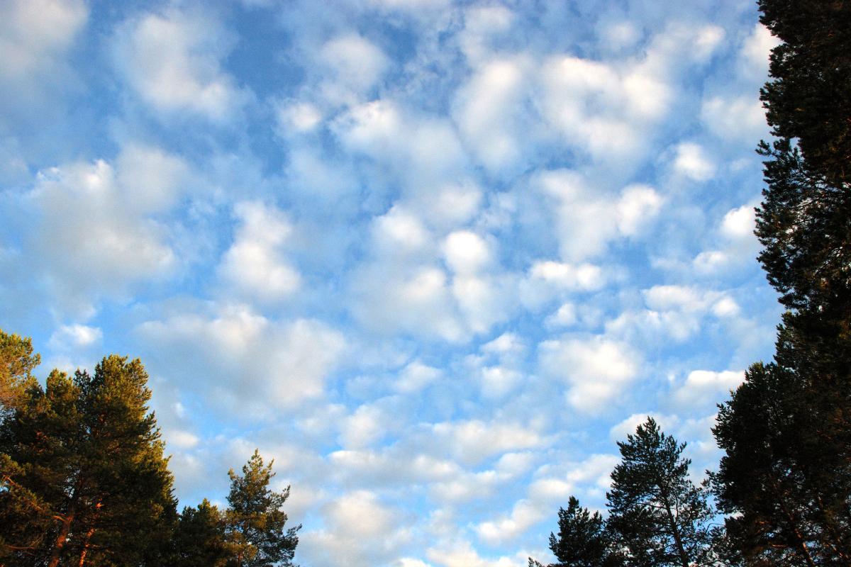
Altocumulus clouds are a group of clouds found in the middle part of the atmosphere, generally at altitudes ranging between 2,000 and 7,000 meters above sea level. These clouds are characterized by their appearance as white or gray cloudlets, often organized in rows or groups. At first glance, they may look like a field of small cotton puffs.
One of the distinctive features of altocumulus clouds is their structure in the form of small cumulus clouds or cloudlets. These cloudlets are of relatively uniform size, sometimes looking like waves or an undulating carpet in the sky. Unlike higher altitude clouds such as cirrus clouds, altocumulus clouds are denser and have a more solid appearance.
There are different types of altocumulus. In fact, it is considered a genus of cloud which contains different subtypes or ‘species’ within it.
Do altocumulus clouds produce precipitation?
Altocumulus clouds do not usually produce significant precipitation. They can be precursors to thunderstorms or rain if they are found together with certain other types of clouds.

Altocumulus cloud formation
The formation of altocumulus clouds is a meteorological process that involves several atmospheric factors. In general, these clouds develop when moist air rises and encounters a cooler layer of air at mid-levels in the atmosphere.
- The first step in the formation of altocumulus clouds is the rise of air containing moisture. This rise can be due to several factors such as warming of the ground that causes the air close to it to rise or larger atmospheric movements such as frontal systems. As warm air rises, it expands due to lower atmospheric pressure at higher altitudes. This expansion process causes the air to cool, a phenomenon known as adiabatic cooling.
- When moist air cools, the air's ability to hold water vapor decreases, leading to condensation in the process. Small water droplets or ice crystals form around dust particles and other aerosols present in the atmosphere.
- This condensation gives rise to the formation of clouds. For altocumulus to form, the atmosphere in the middle layer must be relatively stable. This means that once the air reaches a certain level of altitude, it will not continue to rise freely, but will tend to spread horizontally. This stability prevents clouds from rising too high and helps maintain their characteristic patchy formation.
- Due to the stable conditions and the clumping together of water droplets or ice crystals, altocumulus clouds take on their distinctive appearance of small, rounded cloudlets in formation. These cumulus clouds are often arranged in regular patterns, such as rows or clusters. They can often look like waves in the sky.
- Altocumulus clouds can be observed in various weather conditions, with their presence often signaling different types of climate. For example, when altocumulus clouds are seen in a clear sky, they are usually an indication of good weather. If observed together with vertically developing clouds such as cumulonimbus clouds, they can be an indication of approaching storms.
Learn more about cloud formation of all types with our article on what are clouds and how do they form?
Types of altocumulus clouds
Altocumulus clouds can occur in various shapes and structures, which has led to the identification of different subtypes. In fact, altocumulus is considered a type of cloud genus, similar to animal or plant species. Within the cloud genus altocumulus, the different subtypes have specific characteristics that distinguish them:
- Altocumulus stratiformis: this is one of the most common types of altocumulus cloud. They appear as an extensive layer of clouds that cover large areas of the sky. These clouds are usually thin and allow sunlight to pass through them, creating soft shadows on the ground.
- Altocumulus lenticularis: these clouds have a lens or flying saucer shape, usually forming over mountainous areas due to winds passing over the peaks. The streamlined shape of altocumulus lenticularis is the result of mountain waves. These are created when air moves over elevations and then descends on the opposite side. These clouds are stationary and do not move with the wind, making them easy to identify.
- Altocumulus castellanus: this type of altocumulus is distinguished by having small towers or castles that protrude from the main cloud layer. Altocumulus castellanus usually occur in rows and may be associated with changing weather conditions.
- Altocumulus floccus: these clouds look like cotton puffs or small clusters. They often have small bumps at their bases. They also indicate atmospheric instability and may be precursors to larger, more powerful cloud formations such as cumulonimbus. Learn more about how cumulonimbus clouds form with our related guide.
- Altocumulus perlucidus: this subtype is characterized by having clear spaces between the clouds, allowing you to see the blue sky through them.
- Altocumulus opacus: these clouds are denser and thicker than other types of altocumulus, which prevents them from letting sunlight through.

What type of weather do altocumulus clouds bring?
The presence of altocumulus clouds in the sky usually indicates a relatively stable atmosphere at mid-levels. This means that extreme weather conditions such as severe storms are generally not expected anytime soon. Certain subtypes of altocumulus may signal instability and the development of more active conditions. These include altocumulus castellanus or floccus clouds.
Altocumulus clouds are often observed before a change in weather. For example, if altocumulus stratiformis appear in a clear sky, it may be an indication that a cold front is approaching. This type of cloud can precede other types of denser clouds with a greater capacity to produce precipitation.
Although altocumulus clouds by themselves rarely produce significant precipitation, their presence along with other types of clouds can be an indication that rain or storms are approaching. Altocumulus castellanus and floccus, in particular, may be precursors to the formation of cumulonimbus clouds. These are the clouds are responsible for thunderstorms and heavy rain. They are also an important part of how hurricanes are formed.
In many cases, altocumulus clouds may simply be an indication of good weather with stable atmospheric conditions. This is especially true for altocumulus perlucidus, which allow sunlight to pass through and create a pleasing visual effect in the sky.
Now that you know what altocumulus clouds are, their types and how they are formed, you might want to learn about what is a sea of clouds and how does it form?
If you want to read similar articles to What Are Altocumulus Clouds?, we recommend you visit our Meteorological phenomena category.


